
Which region should I focus my wind farm development efforts on?
Vortex MAPS delivers regional wind resource maps at 1 km and 3 km resolution, covering any area worldwide — onshore and offshore. At the prospecting stage, MAPS enables developers to quickly screen multiple territories, compare wind resource potential, and narrow down viable sites before committing to field measurements. The WAsP Wind Atlas export feature allows results to be refined to any resolution for more detailed analysis.
Where should I install a meteorological mast to measure wind resource?
Vortex MAST generates virtual met mast simulations at any candidate location, allowing developers to evaluate potential measurement positions before committing to physical installation. This reduces the risk of misplacing an expensive mast. For sites where turbulence and microscale atmospheric behavior are critical, Vortex LES provides 100 m resolution simulations that replicate met mast measurement conditions with greater fidelity than standard flow models.
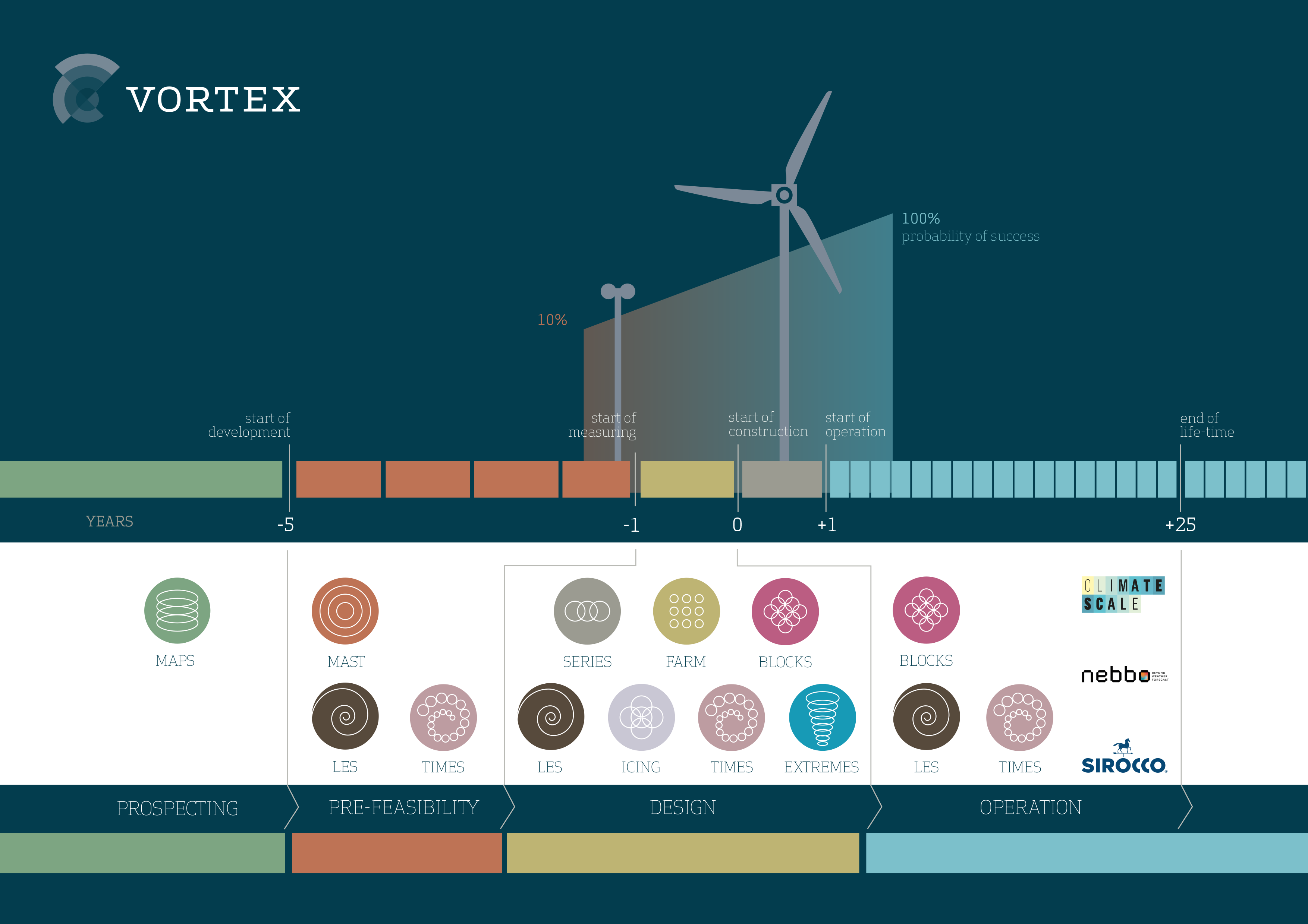
How do I select turbine class and optimize wind farm layout?
Vortex FARM provides Wind Resource Grid (WRG) files and high-resolution wind resource maps covering all variables required for turbine class selection and micrositing: mean wind speed, turbulence intensity, wind shear, extreme wind (Vref), air density, and temperature. Compatible with WAsP, WindPRO, and OpenWind, FARM integrates directly into the engineering workflow without additional data conversion.
How profitable will my wind farm be?
Once measurements are available, SERIES makes your wind farm development more reliable by making your measurements bankable through long-term extrapolation of historical wind data and modeled wind resource data.
Wind Farm Development
Vortex provides on-demand modeled wind resource data for wind energy professionals at every stage of project development — from early-stage regional prospecting to bankable energy yield assessments and structural load analysis. Each product in the Vortex portfolio is generated specifically for your site, on demand, using non-linear WRF modeling and ERA-5 reanalysis data, without relying on pre-computed global databases. The result is higher accuracy, at lower cost, than traditional consultancy — accessible directly from your browser, at any coordinate worldwide.
Since 2009, Vortex has provided modeled wind resource data to wind energy developers, independent engineers, and financial institutions across more than 150 countries. Unlike pre-calculated global databases, every Vortex dataset is generated on demand — computed specifically for the client’s site, at the requested resolution, using the full WRF non-linear modeling chain. This approach eliminates the spatial averaging and resolution trade-offs inherent in pre-computed products, delivering data that is measurably more accurate for bankable wind resource assessment and wind farm design.
Get Started Today
Sign up for your free account and gain access to wind data at any coordinate worldwide.
Modeled wind resource data for the wind industry.
At any site around the world. Onshore and offshore.