Comprehensive datasets designed for professional wind resource assessment during early and intermediate wind farm development stages.
Vortex FARM provides long-term wind resource statistics across the entire project area, delivering consistent data at all relevant heights together with high-resolution maps of mean wind speed, temperature, extreme wind speed (Vref), and turbulence intensity. This area-wide approach allows engineers and developers to perform robust wind resource assessment studies before final turbine locations and classes are defined.
Vortex FARM allows multiple calibrations to be performed to adapt as projects evolve and measurement datasets expand over time and across additional measurement heights.
Vortex FARM enables project teams to extend their wind resource assessment beyond standard model outputs by providing high-resolution data and flexible extraction tools. Engineers can identify areas with optimal wind conditions, assess potential design constraints, and support early decisions on turbine class and layout. This approach ensures that every assessment is grounded in validated datasets, facilitating efficient project development for both onshore and offshore wind farms worldwide.
Comprehensive Site Coverage – Spatially consistent long-term wind statistics across the entire project area.
Full Rotor-Swept Analysis – Multi-height wind data (30 m to 300 m) to accurately characterize shear and inflow angles across the entire rotor diameter.
Site Suitability & Safety – Long-term extreme wind Vref and sector-wise turbulence evaluation to verify IEC turbine class compliance.
Reduced Uncertainty – Seamless integration of on-site met mast data to calibrate the long-term modeled grid for bankable results.
Design-Ready Integration – Industry-standard outputs (WRG, TAB, KML) for immediate use in WAsP, WindPro, OpenWind, and WindFarmer.
When to Use FARM
Vortex FARM is typically used when the wind farm area has already been defined and a comprehensive wind resource assessment is required, but turbine locations and turbine classes are still under evaluation. It provides the necessary wind resource context to support early technical decisions before detailed micrositing and energy yield assessment.
Vortex FARM delivers spatially consistent data tailored for comprehensive site analysis. The dataset enables a detailed evaluation of meteorological conditions across the entire project area, supporting precise comparisons between different locations and the identification of zones with distinct wind characteristics.
It is especially suitable for:
Full-Field Mapping: Complete wind climate characterization across the entire project area.
Early-Stage Assessments: Fast, data-driven wind studies for preliminary project feasibility.
Site Suitability: Detailed evaluation of extreme winds Vref and turbulence intensity.
Layout & Class Selection: Supporting initial turbine spacing and IEC class definition.
All outputs are generated with uniform resolution and standardized modeling assumptions, ensuring reliable internal benchmarking across the assessed domain.
How Can Vortex FARM Help You?
Technical Details
Fully selectable areas in size (up to 4.000 km²), location and orientation.
The FARM area is rectangular with a fixed aspect ratio.
100 m resolution.
All heights between 30 and 300 m included.
The dataset can be calibrated multiple times using measurements (up to 4 calibrations included in the price).
Both WRG files, calibrated and uncalibrated, will be available to download.
Unlimited turbine location outputs within the selected area.
It is possible to extract .tab files at any point on the map.
Wind speed histograms with their Weibull fits.
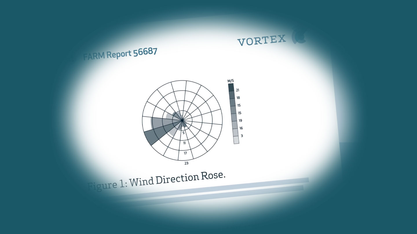
16 sectors wind direction rose.
50 years extreme wind speed (Vref) via 30 years Gumbel fit.
Characteristic turbulence intensity distribution in speed bins.
Sector-wise inflow angle and vertical shear.
Exportable to Google Earth KML, ESRI grid, WAsP WRG files for WindPro, WindFARMer, OpenWind and WRB files for OpenWind.